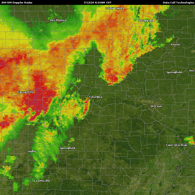
Traffic Info Traffic maps provide a visual presentation of road conditions by color for all the major metropolitan areas across the globe, supported by in-depth traffic descriptions for the 52 largest metro areas in the US presented by highway/road segment, Jam Factor™, Jam Trending™, criticality and problem description. Available in Maps, Data or both
Read more
Live Traffic Data