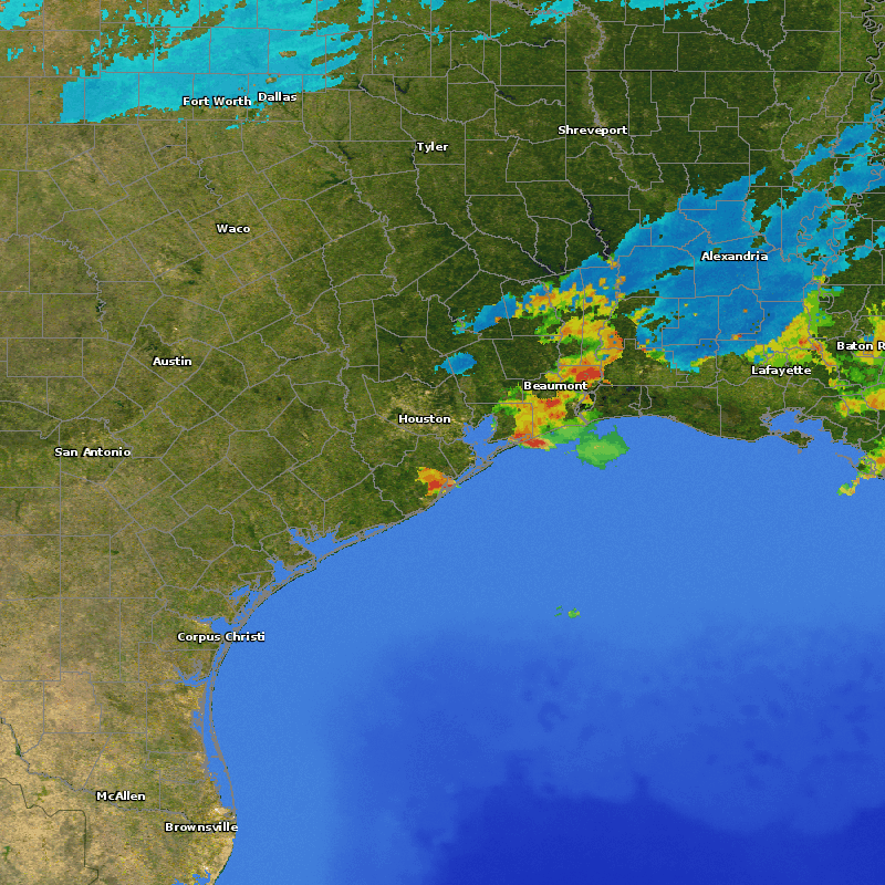
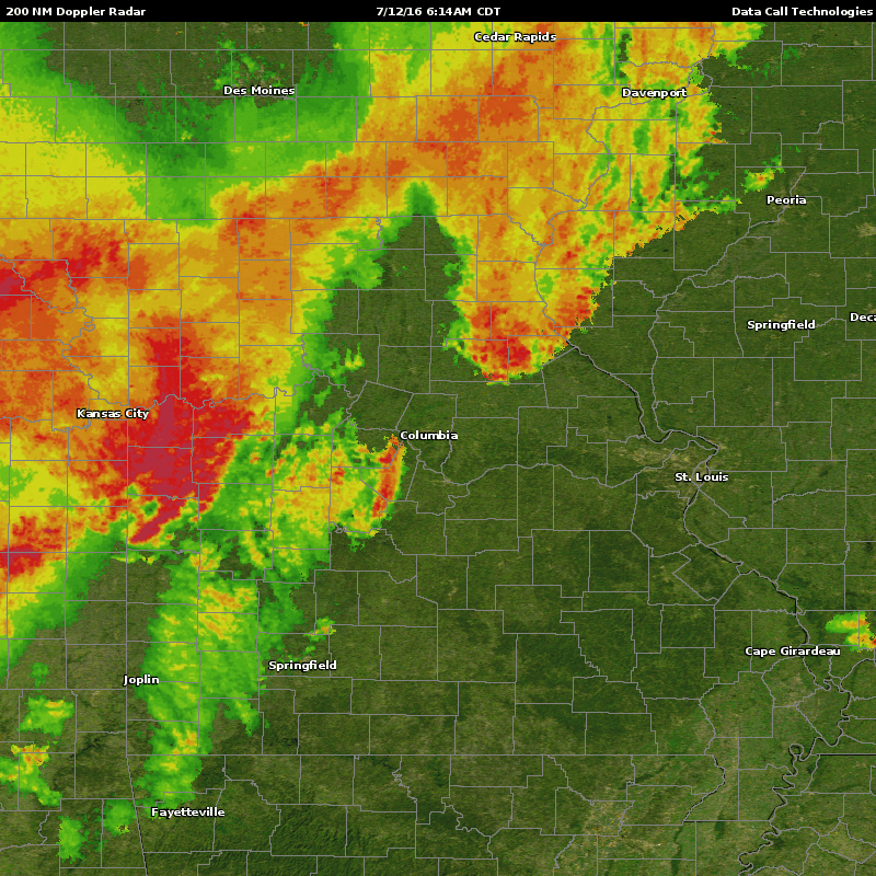
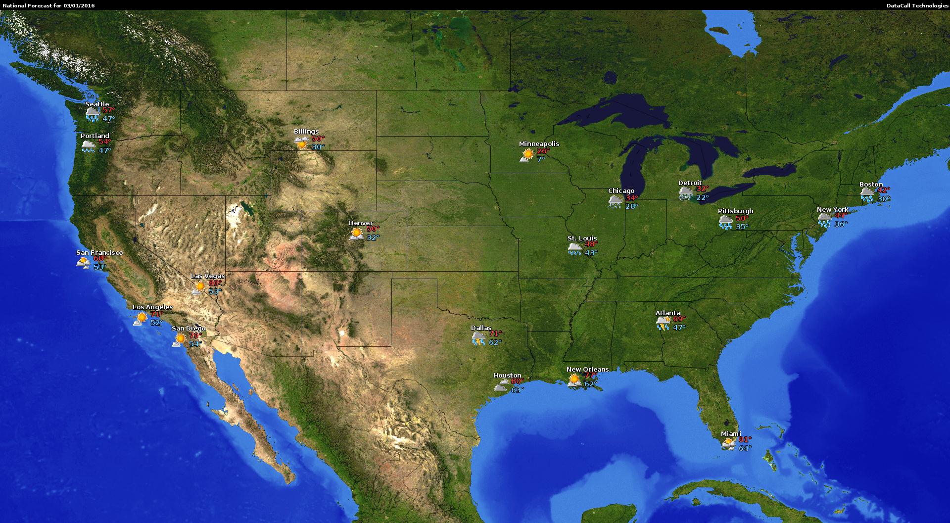
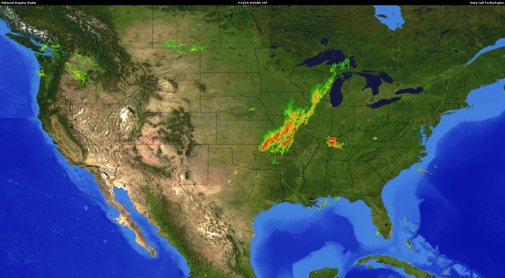
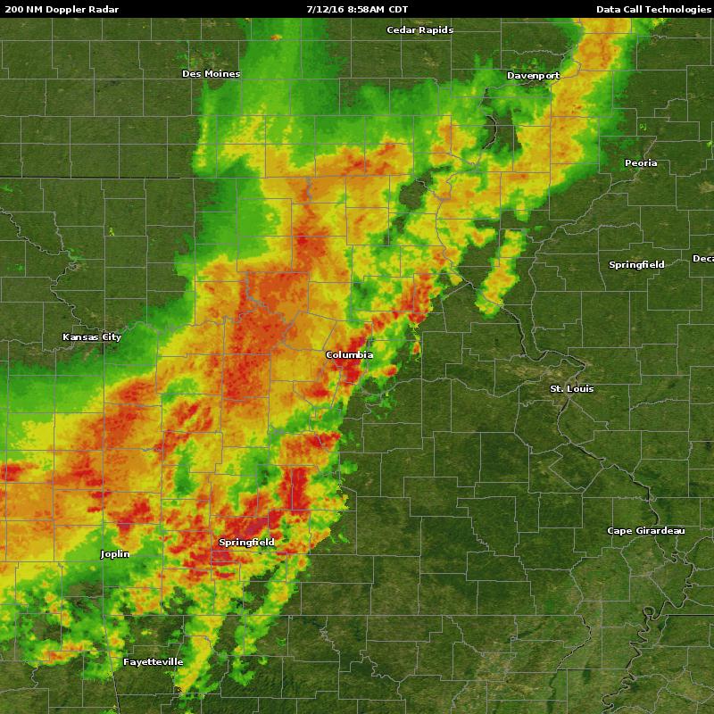
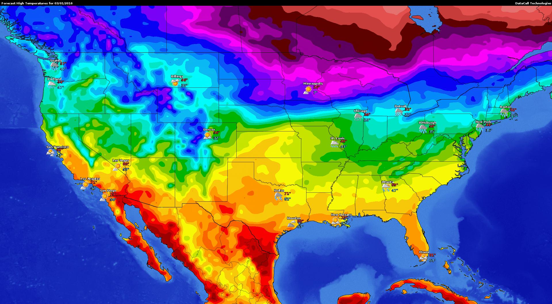
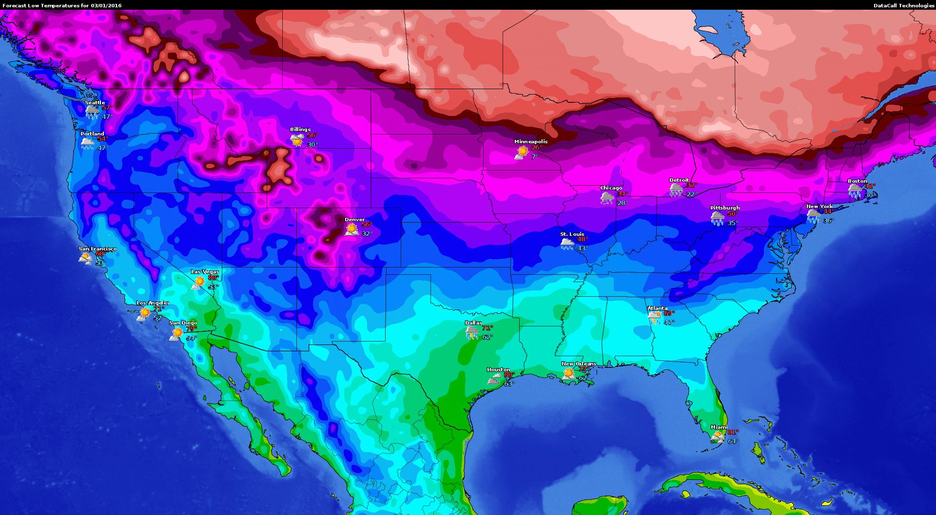
Be alert with local doppler maps
Local doppler images using either a Zip Code or Airport ICAO code. Data Call uses high resolution doppler radar images to give you the most accurate storm data the moment it happens.
Items included : Either Static JPEG or Animated GIF, nearby city identifies, doppler weather information
Delivered in multiple formats in size a 1:1 ratio.